5 nights · default stay

Brazil · Nature · Ecotourism · Nature gateway

Serra do Cipó

Rocky grasslands, waterfalls and long hikes make Serra do Cipó a rewarding nature escape from Belo Horizonte.

Recommended stay4–6 nights
Ease of travel8/10
First Brazil trip7/10
Infrastructure7/10
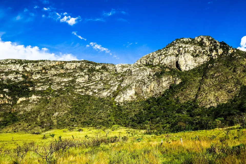
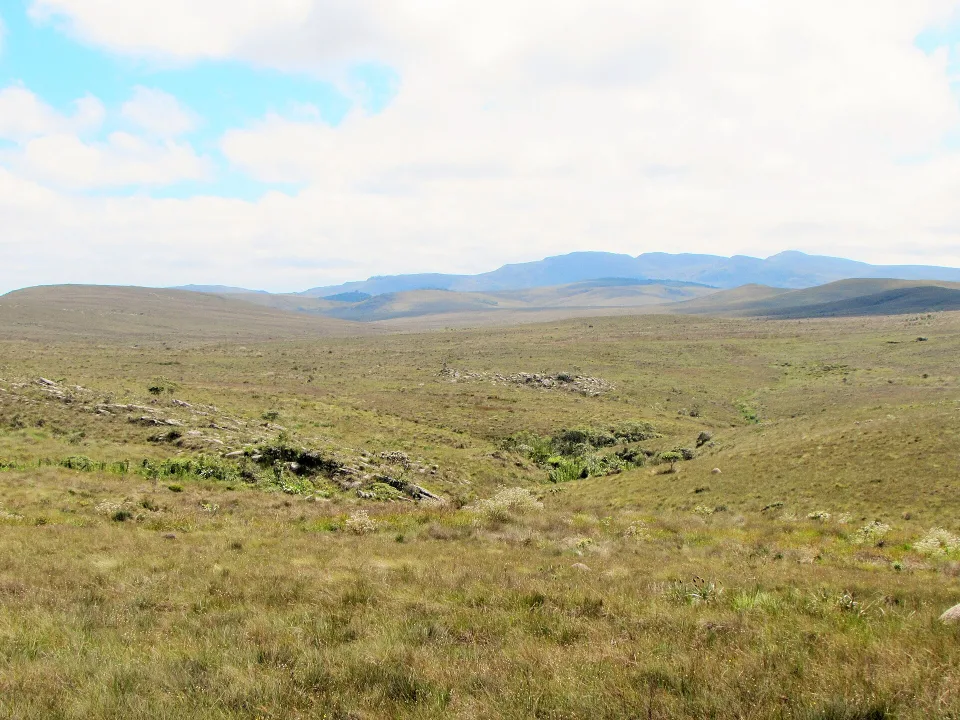
Mountain grasslands and rocky landscape in Serra do Cipó, Minas Gerais
19.34°S · 43.62°W Nature
Photo: Fabricio Ferreira Silva · CC BY-SA 3.0

Why this place

Serra do Cipó

Serra do Cipó combines a national park, rugged Espinhaço landscapes, waterfalls, canyons, endemic flora and a strong hiking culture only a few hours from Belo Horizonte. It works both as an accessible nature break and as the beginning of longer mountain routes toward Lapinha, Conceição do Mato Dentro and the wider Espinhaço.

Serra do Cipó is both a popular nature district and a national park. Not every local waterfall is inside the park, and a privately operated day attraction will have different access rules from an ICMBio trail.

Cachoeira da Farofa requires a proper walking plan, while other sights near the village may be more accessible by road. The highland campos rupestres protect distinctive plants and birdlife; staying on marked routes matters even when the landscape looks open.
The Brasilll take

Why this place is worth exploring

Serra do Cipó is both a popular nature district and a national park. Not every local waterfall is inside the park, and a privately operated day attraction will have different access rules from an ICMBio trail.

Why this place is worth exploring

01

A park and a wider region

Not all named waterfalls follow the same ticket or entry rules.

02

Check exact distances

The Farofa trip is much longer than its photograph suggests.

03

Watch the weather

Hot sun and rain can change safe trail and river conditions.

Before you book

Serra do Cipó: Farofa and Bandeirinhas are long, separate park hikes

Check the correct Areias or Retiro gate, total return distance, latest entry time and stream conditions before committing to a waterfall trail.

01

Farofa means an out-and-back hiking day, not a roadside stop

Jaboticatubas municipality describes roughly 8 km to Cachoeira da Farofa from the Areias access, so plan the return distance too and do not start late. Confirm the route with Serra do Cipó National Park, the current last entry/exit times and whether bicycles are actually permitted on your chosen path. Take drinking water, food, suitable footwear and sun protection; a flatter trail can still be long and tiring. The village's privately managed waterfalls use different entrances and admission arrangements, not the same park visit.

02

Bandeirinhas is longer and river crossings can end the plan

The municipality describes around 12 km to Cânion das Bandeirinhas plus return, with crossings of streams and rocky sections. Check real weather, water level, the ranger's last permitted start time and your party's fitness before leaving Areias. Never cross a rising river during or after thunderstorms; flash floods can occur even when rain falls upstream. If this route is unsafe, do not invent a shortcut. Choose an officially open shorter park walk or a separately ticketed, verified attraction near the village.

03

Choose a lodging base and a legitimate access arrangement

The ICMBio visitor pages describe the national park and its rules, while a tourism address under 'Serra do Cipó' may not put you near Portaria Areias or Portaria do Retiro. Match the actual lodge address to the selected trailhead, confirm transport and return road time, then ask if the specific outing needs a guide, booking or other arrangements; do not generalise across all park routes. If a private waterfall is outside the park, contact that operator directly for current prices, opening and swimming rules.

At a glance

Brasilll scorecard

The same 0–10 scale is used across the catalogue, so strengths and compromises stay comparable.

These are editorial fit ratings, not visitor-review averages or safety guarantees. A high score describes a strength for a particular kind of trip. How to read these scores →

Culture6/10
Food7/10
History7/10
Nightlife3/10
Beach1/10
Nature10/10
Wildlife9/10
Adventure10/10
Local feel8/10
Photography10/10
Original photograph of Serra do Cipó in Brazil
Photo: Vinícius de Souza Naves / Wikimedia Commons · CC BY-SA 4.0 · Cropped for layout

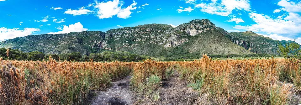
The walk is part of the destination

Serra do Cipó: grassland before the waterfall

Vinícius de Souza Naves created this broad landscape panorama of the route to Cachoeira da Farofa in May 2017. It shows the open rocky grasslands that make the hiking experience distinct from a quick waterfall photo. The park's official routes can require many kilometres on foot or by bicycle. Check the current trail, access gate, heat, water supply and return time before setting out; a gentle-looking panorama does not measure your walking effort.

See the practical trip plan

Where to stay

Four sides of the region

Distinguish village, national-park walks, highland nature and privately managed waterfall sites.

Village and lodges

A convenient base for meals, transport and simpler excursions.

National-park lowland trails

Farofa and other routes require real distances and an appropriate gate.

Campos rupestres

Highland scenery and plants are sensitive to trampling.

Private waterfall sites

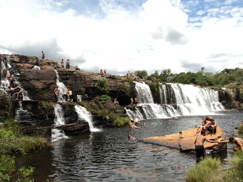
Cachoeira Grande and other attractions follow their own admission rules.

Travel smarter

Key things to plan

Confirm the official gate, route distance, weather and any separate private admission before heading out.

01

A park and a wider region

Not all named waterfalls follow the same ticket or entry rules.

02

Check exact distances

The Farofa trip is much longer than its photograph suggests.

03

Watch the weather

Hot sun and rain can change safe trail and river conditions.

Weather & timing

When to go

Season matters. These monthly scores combine our current baseline for climate, access and overall travel fit.

Monthly ratings are broad planning guidance, not a weather forecast or confirmation that every activity is operating.

Jan7/10
Feb7/10
Mar7/10
Apr8/10
May9/10
Jun10/10
Jul10/10
Aug10/10
Sep9/10
Oct8/10
Nov7/10
Dec7/10

Build your route

Four-day itinerary

A realistic four-day plan separates the long Farofa walk from a shorter waterfall visit.

Day 1

Village arrival

Choose accommodation by entrance and check ICMBio route updates.

Day 2

Farofa trail

Spend a full day on one long, weather-appropriate park walk.

Day 3

Different waterfall

Visit a separately managed waterfall with confirmed admission.

Day 4

Highland landscape

Try a gentler viewpoint or a second suitable trail.

Original photograph of Cachoeira da Farofa in Brazil
Photo: Lucas.damatta / Wikimedia Commons · CC BY-SA 4.0 · Cropped for layout

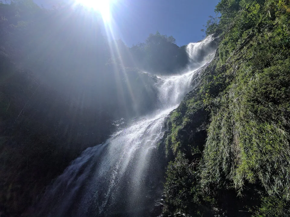
A different waterfall from Cachoeira Grande

Cachoeira da Farofa: give the trail a full day

Lucas.damatta photographed Cachoeira da Farofa inside Serra do Cipó National Park in April 2017. It is a separate outing from the commercially accessed Cachoeira Grande shown elsewhere in the guide. Even if the waterfall looks easy to reach in a picture, allow substantial walking time, sun exposure and a safe return. Confirm whether bathing is allowed at the site under current park rules and avoid slippery rock near the cascade.

See the practical trip plan

Travel styles

Who does it suit?

These comparative scores show who is likely to enjoy this destination most—and where expectations may need adjusting.

Repeat Brazil travellers10/10
Couples10/10
Active travellers10/10
Slow travel9/10
Backpackers9/10
Families with teenagers9/10
Friends9/10
Solo9/10

Brasilll

How long to stay?

Four nights give two contrasting hikes and an easier waterfall or village day. Choose accommodation according to the actual park entrance and tracks, not only a broad Serra do Cipó label. The Farofa route can involve a long return distance, so verify your group's abilities and the day length.

Four nights give two contrasting hikes and an easier waterfall or village day. Choose accommodation according to the actual park entrance and tracks, not only a broad Serra do Cipó label. The Farofa route can involve a long return distance, so verify your group's abilities and the day length.

The weather can shift quickly. Warm, exposed stretches call for water and early departures, while rainy periods make river crossings and rocky paths harder. Some facilities charge separate entrance fees; do not assume national-park access covers privately managed waterfalls.

Found an outdated price, route or detail? Send the page URL, the information that needs changing and a supporting source if available.

Report an error →

Does this sound like your Brazil?

Use Find Your Brasil to compare this destination with the rest of the country using your own priorities.

Plan Brazil

Getting there & moving on

Use these rounded door-to-door estimates to judge the travel day. Confirm the actual service and departure time before booking.

Arrival base

Serra do Cipó

Typical access Road

Choose lodging by the park entrance, waterfall circuit or village activities you want. A Serra do Cipó address alone does not tell you how much local driving is needed.

Good onward connections

These are selected options for your next stop. Confirm operating days, connections and total travel time for your dates.