4 nights · default stay

Brazil · Nature · Ecotourism · Expedition

Itatiaia & Agulhas Negras

High granite peaks and misty forest waterfalls. Itatiaia has two very different sides.

Recommended stay3–5 nights
Ease of travel7/10
First Brazil trip7/10
Infrastructure7/10
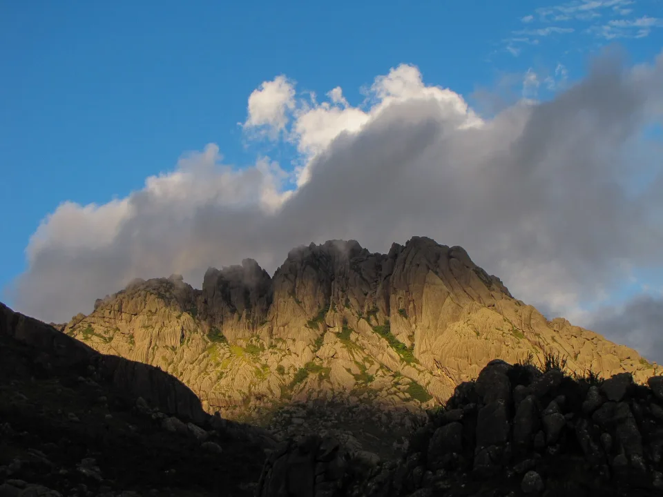
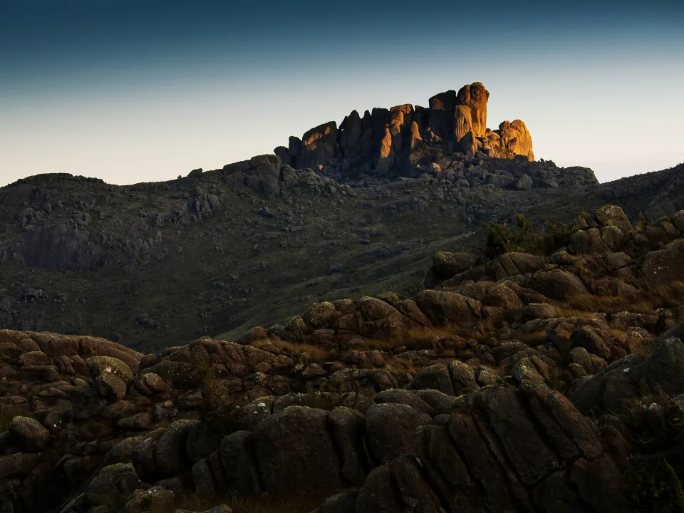
Pico das Agulhas Negras in Itatiaia National Park
22.37°S · 44.66°W Nature
Photo: KarlaFPaiva · CC BY-SA 3.0

Why this place

Itatiaia & Agulhas Negras

Itatiaia National Park spans the Mantiqueira between Rio de Janeiro and Minas Gerais and combines two very different experiences. The lower section protects Atlantic Forest, waterfalls and rich birdlife; the high plateau contains alpine-style grasslands, Prateleiras and Pico das Agulhas Negras, one of Brazil’s classic mountaineering objectives. Travellers can build anything from gentle nature days to technical summit outings.

The upper park near Agulhas Negras is exposed, cooler and more demanding; the lower park has Atlantic Forest walks and waterfalls. They use different approaches, so one 'Itatiaia day' rarely covers both well.
Before you book

Itatiaia: choose the park sector before booking a trail

The forest waterfalls and the Agulhas Negras high plateau have different gates, roads and difficulty. The summit is a technical activity, not a general park ticket.

01

Which gate? Lower forest or upper mountains

ICMBio's official maps separate Parte Baixa, accessed from the Itatiaia side for Véu de Noiva and Maromba, from Parte Alta via BR-354 towards Posto Marcão for Rebouças, Prateleiras and Agulhas Negras. The two sectors are not adjacent parking areas: decide your route before choosing the hotel and check real road transfer times. Park registration or entry at one gate does not guarantee access to a specific upper mountain route.

02

Agulhas Negras: ask about the exact booking and technical requirements

ICMBio reported in April 2026 that visitors who ignored staff warnings, a required prior reservation, safety equipment and a closed route on the Agulhas Negras ascent were fined. A view of the peak and a technical summit are not equivalent. Confirm the current official booking procedure, approved trail, suitable experience, specialist guiding if appropriate, gear and cutoff time at Posto Marcão before paying. Never take a closed path just because an old map shows it.

03

If the upper access road or weather fails, choose a lower-sector day

The park warned in April 2026 that the road approaching the Parte Alta is difficult for small cars, particularly in rainy conditions. Even if the valley is warm, the plateau can be cold, exposed and misty. Verify the vehicle and gate status locally, download the park's updated maps for offline navigation, and keep the lower-sector visitor centre or accessible forest stops as a genuine backup; after heavy rain also check waterfall bathing hazards.

At a glance

Brasilll scorecard

The same 0–10 scale is used across the catalogue, so strengths and compromises stay comparable.

These are editorial fit ratings, not visitor-review averages or safety guarantees. A high score describes a strength for a particular kind of trip. How to read these scores →

Culture5/10
Food7/10
History8/10
Nightlife3/10
Beach0/10
Nature10/10
Wildlife9/10
Adventure10/10
Local feel8/10
Photography10/10
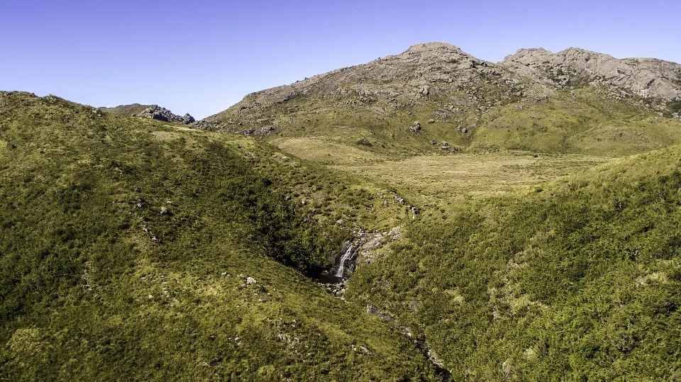
Aiuruoca waterfall with Ovos da Galinha rock formation in upper Itatiaia
Photo: Gilcimar Soares Liberato / Wikimedia Commons · CC BY-SA 4.0 · Cropped for layout

The upper park is its own world

Aiuruoca: water and rock at altitude

Gilcimar Soares Liberato photographed Aiuruoca Waterfall and the distinctive Ovos da Galinha rocks in 2017. The highland scene shows open terrain rather than the dense forest of the lower park. Wind, temperature, distance and route permissions matter here; check the chosen trail instead of assuming any viewpoint is a short walk.

View the relevant planning section

Where to stay

Itatiaia is two separate trips: lower forest and high mountains

Upper-park peaks and lower-park forest waterfalls require different plans.

Lower Sector / Parte Baixa — Itatiaia town side

The lower entrance is reached from the Itatiaia area off the Presidente Dutra BR-116. ICMBio's lower-sector map covers the visitor centre, Véu de Noiva waterfall, Maromba pools and Três Picos trail. This is the forest-and-waterfall choice, with different weather, access and walking difficulty from the high plateau.

Upper Sector / Parte Alta — BR-354 and Posto Marcão

ICMBio places the mountain approach on the BR-354 between Itamonte (MG) and Engenheiro Passos (RJ), leading to the separate upper access road and Posto Marcão. This is not a second car park next to the lower waterfalls. The park warned in April 2026 that wet-season road damage still makes the upper approach difficult for small cars.

Abrigo Rebouças and the high plateau — a base, not a summit pass

The upper sector includes Rebouças, Prateleiras, Morro do Couto, Pedra do Altar and other highland routes. Choose the specific trail after checking park maps, difficulty, current weather and registration rules. Reaching Rebouças or a viewpoint does not confer automatic permission to climb Agulhas Negras.

Pico das Agulhas Negras — technical objective, not a casual hike

The park's April 2026 enforcement notice describes fines after visitors disregarded staff warnings, a required prior booking and suitable equipment, and used a prohibited route. If you want the summit, arrange the correct current permit or booking, experienced specialist guidance where appropriate and suitable gear. Inexperienced walkers should select a clearly approved non-technical viewpoint instead.

Travel smarter

Four checks before mixing mountains with waterfalls

Check ICMBio access, high-altitude trail rules, weather and the correct park entrance.

01

Lower and upper park gates are geographically separate

Plan the lower side through Itatiaia and the upper side through the BR-354 / Itamonte-Engenheiro Passos approach. Budget realistic road time; one day in the park is not automatically one day in both sectors.

02

High-sector access roads can be difficult

ICMBio reported in April 2026 that the upper approach remains challenging for small cars, especially after rain. Confirm passability and vehicle suitability before departure rather than trusting a simple navigation-app travel time.

03

Agulhas Negras requires the right access and experience

The park fined visitors in a 2026 case for ignoring route closure, prior booking requirements and technical equipment warnings. Confirm current permits and trail rules with the park and consider a qualified mountain guide.

04

Download official maps, but obey closures and staff advice

ICMBio provides separate offline-capable maps for Parte Alta and Parte Baixa. These help plan, but do not override trail closures, visitor caps, exposed weather or requirements given at Posto Marcão.

Weather & timing

When to go

Season matters. These monthly scores combine our current baseline for climate, access and overall travel fit.

Monthly ratings are broad planning guidance, not a weather forecast or confirmation that every activity is operating.

Jan7/10
Feb7/10
Mar8/10
Apr9/10
May10/10
Jun10/10
Jul10/10
Aug10/10
Sep9/10
Oct8/10
Nov7/10
Dec7/10

Build your route

Three Itatiaia days with the sectors kept separate

Choose a clear-weather highland day, then a separate forest-waterfall day with the correct entrance.

Day 1

Waterfalls and forest trails in Parte Baixa

Use the lower entrance for the visitor centre, a weather-appropriate waterfall outing and an optional short forest walk. Ask about bathing safety and flash-flood risks after rain; do not try to add the distant high-sector road later the same afternoon.

Day 2

A preplanned highland day on a suitable trail

Start early for the distinct upper entrance, check road condition and register at the required park post. Choose a permitted plateau viewpoint or a suitable non-technical trail; carry warm clothing, water, navigation and a full weather margin even when it is hot in the valley.

Day 3

Reserved technical ascent OR an easier nature day

Only trained, properly equipped travellers with confirmed park permission should attempt technical objectives such as Agulhas Negras. Other visitors can choose another approved trail, a relaxed birding day in the lower forest or a spare day if the upper road or weather is unsuitable.

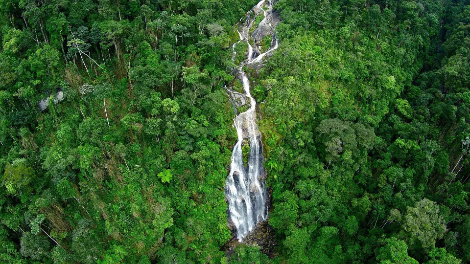
Aerial view of Véu da Noiva waterfall in lower Itatiaia National Park
Photo: Alexandre Cesar Salem e Silva / Wikimedia Commons · CC BY-SA 3.0 · Cropped for layout

Down in the Atlantic Forest

Véu da Noiva: the greener Itatiaia

Alexandre Cesar Salem e Silva's aerial photograph from 2015 shows Véu da Noiva waterfall within the lower park's green landscape. This is a different visit from the high granite peaks. Check trail access and rainfall before setting out; a waterfall viewpoint is not an invitation to enter the plunge pool.

View the relevant planning section

Travel styles

Who does it suit?

These comparative scores show who is likely to enjoy this destination most—and where expectations may need adjusting.

Repeat Brazil travellers10/10
Active travellers10/10
Slow travel9/10
Backpackers9/10
Families with teenagers9/10
Friends9/10
Couples9/10
Solo9/10

Brasilll

How long should you stay?

We recommend 3–5 nights as a starting point. Include the arrival and departure journeys in your plan, then adjust the stay around the local outings you choose.

Set aside separate days for the upper and lower park, plus a weather buffer if your main goal is a high-altitude trail. Summit access is not the same as a casual viewpoint walk.

Found an outdated price, route or detail? Send the page URL, the information that needs changing and a supporting source if available.

Report an error →

Does this sound like your Brazil?

Use Find Your Brasil to compare this destination with the rest of the country using your own priorities.

Plan Brazil

Getting there & moving on

Use these rounded door-to-door estimates to judge the travel day. Confirm the actual service and departure time before booking.

Arrival base

Itatiaia

Typical access Road

Decide between lower-park forest visits and the upper mountain sector before choosing accommodation. Confirm the entrance and road approach that match your actual route.

Good onward connections

These are selected options for your next stop. Confirm operating days, connections and total travel time for your dates.