6 nights · default stay

Brazil · Expedition · Ecotourism · Nature

Jalapão

Golden dunes, clear fervedouros and powerful waterfalls make Jalapão unforgettable. The real challenge is planning the long 4x4 route between them.

Recommended stay5–6 nights
Ease of travel3/10
First Brazil trip6/10
Infrastructure3/10
Golden dunes in the Cerrado landscape of Jalapão, Tocantins
10.25°S · 46.50°W Expedition
Photo: Alexandre Marino · CC BY-SA 2.0

Why this place

Jalapão

Jalapão is not one attraction or one town but a large travel region in eastern Tocantins. Dunes, clear rivers, waterfalls, sandstone formations, fervedouros and quilombola communities are linked by long distances and rough roads, making logistics part of the experience rather than background detail.

Jalapão rewards travellers who enjoy the journey as much as the stops. Its signature dunes rise from the Cerrado near Serra do Espírito Santo, but they are only one part of a wide region crossed by sandy tracks. A route through Ponte Alta, Mateiros and São Félix takes days, even when the map looks compact. Book a competent local operator with a suitable vehicle; an ordinary rental car, limited fuel range or a tight flight connection can turn a beautiful trip into a logistical problem.

The park dunes and Serra do Espírito Santo are regulated attractions, not open playgrounds. Naturatins’ published May 2024 regulation requires a visitor voucher, validation by an authorised guide or environmental conductor and adherence to marked routes; walking the steep dune face, leaving designated boundaries and flying drones without specific permission are restricted. The exact visitor capacity and time windows may change under later rules, so ask your operator to confirm the current voucher for your chosen date rather than relying on an old sunset photograph.
The Brasilll take

Jalapão is an expedition-style road journey disguised as a collection of beautiful swimming stops.

The famous fervedouros, golden dunes and waterfalls are real highlights, but the defining experience is the distance between them. Rough roads, 4x4 transfers, small communities and big Cerrado horizons mean the journey itself is part of the destination.

What defines Jalapão

01

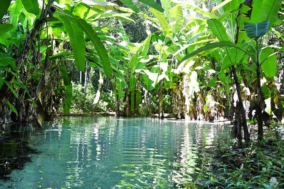
Fervedouros are genuinely unusual

Strong spring pressure makes sinking difficult in the clear pools. They are small, controlled environments, so visits are brief and work best as part of a wider route.

02

The dunes explain the scale

The golden dune field against Serra do Espírito Santo is one of the region’s defining landscapes and works best near late afternoon when heat drops.

03

Community tourism matters

Quilombola communities such as Mumbuca connect the trip with golden-grass craft and local history, adding cultural depth to a route often sold only through nature.

Before you book

Jalapão: book the right vehicle, authorised guide and water stops

The park spans long sandy roads and different visitor systems. A fervedouro, dune sunset and community visit each need a suitable operator and real time between locations.

01

Use an experienced 4x4 driver and a route with actual overnight bases

Ponte Alta, Mateiros and São Félix do Tocantins are separate route stages, not nearby suburbs. Most first-time travellers need a competent 4x4 operator for sand, limited phone signal and rain-affected tracks. Ask the itinerary for overnight towns, fuel, drinking water, roadside assistance and flight-return buffer before paying.

02

Dunes have visitor controls; springs set their own entrance rules

The Jalapão State Park limits visits to the dunes and certain protected stops through regulated guides, time windows and visitor procedures. The municipality lists separate fervedouros with their own contacts and arrangements. Confirm authorisation, current voucher or entry system, group size, bathing duration and access fees for each stop; a single 'Jalapão entry ticket' is misleading.

03

Mumbuca is a host community, not an automatic souvenir stop

Mateiros identifies Mumbuca as a community known for capim-dourado craft. If your route includes it, ask how the visit is arranged with resident artisans and whether purchases benefit them directly. Do not turn people or their homes into an uninvited photography opportunity; the cultural experience deserves its own respectful time.

At a glance

Brasilll scorecard

The same 0–10 scale is used across the catalogue, so strengths and compromises stay comparable.

These are editorial fit ratings, not visitor-review averages or safety guarantees. A high score describes a strength for a particular kind of trip. How to read these scores →

Culture7/10
Food6/10
History5/10
Nightlife1/10
Beach5/10
Nature10/10
Wildlife8/10
Adventure10/10
Local feel9/10
Photography10/10
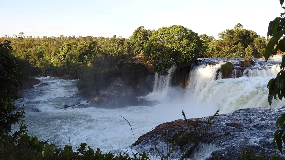
Original wide photograph of the powerful Cachoeira da Velha waterfall in Jalapão, Tocantins, Brazil
Photo: Alexandre Marino / Wikimedia Commons · CC BY-SA 2.0 · Cropped for layout

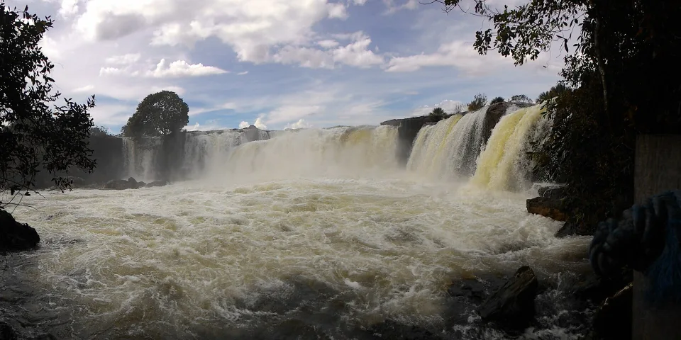
A stop to admire, not to swim

Cachoeira da Velha: the powerful side of Jalapão

This original July 2023 landscape photograph shows the broad, forceful Cachoeira da Velha in Jalapão. It is a very different water experience from the gentle fervedouros: the waterfall is not a safe place to bathe. Ask your route operator whether the authorised lookout is on your particular day’s track, how long the detour takes and what happens if seasonal water levels or park restrictions change access. Stay within signed viewing areas and leave the swimming for a confirmed spring stop.

Compare Jalapão’s four route anchors

Where to stay

Four anchors of a Jalapão route

Choose the route before the sights: Ponte Alta is the western gateway; Mateiros is useful for dunes, selected springs and Mumbuca; São Félix opens a northern return. The unpaved roads between these places are a real part of every day.

Ponte Alta

Common western gateway for Pedra Furada, canyons and the start of the rough-road circuit from Palmas.

Mateiros

The core base for dunes, several fervedouros and access to community experiences around Mumbuca.

São Félix do Tocantins

Northern base for more fervedouros and route variations before returning toward Palmas.

Road between the bases

A major part of the experience: long unpaved transfers through open Cerrado rather than dead travel time.

Travel smarter

Logistics are not optional here

The May 2024 Naturatins rule requires vouchers and registered accompaniment at the dunes and Serra do Espírito Santo. Confirm any subsequent changes and keep waterfall viewpoints separate from spring swimming.

01

4x4 capability matters

Road conditions can be sandy, corrugated or muddy. Most first-time visitors are better served by experienced local operators than by improvising with an unsuitable rental car.

02

Dry season is easier

May to October is the drier period; June to September generally gives the easiest balance of road conditions, clear skies and outdoor comfort.

03

Expect early starts and long days

Distances are large and attractions are dispersed. A good itinerary limits daily backtracking rather than trying to collect every fervedouro.

Weather & timing

When to go

Season matters. These monthly scores combine our current baseline for climate, access and overall travel fit.

Monthly ratings are broad planning guidance, not a weather forecast or confirmation that every activity is operating.

Jan6/10
Feb6/10
Mar6/10
Apr7/10
May9/10
Jun10/10
Jul10/10
Aug10/10
Sep10/10
Oct9/10
Nov7/10
Dec6/10

Build your route

A strong first route in five to six days

Use the six-day west-to-east loop to avoid repeated backtracking. Build in daylight for the dirt roads, approved dune entry, separate spring time slots and a conservative return to Palmas.

Day 1

Palmas to Ponte Alta

Travel from Palmas to Ponte Alta do Tocantins with a suitable four-wheel-drive operator and treat this as the beginning of a multi-day circuit, not an airport-to-resort transfer. Confirm where you sleep, whether the first stop at a local canyon or viewpoint is actually on the chosen route, and whether the operator provides water and luggage space. Rural roads beyond the paved sections can be sandy, slow or affected by rain.

Day 2

Canyons, waterfalls and road time

Make the next day a controlled west-to-east transition with one or two well-chosen waterfall or canyon visits rather than trying to stop at every photo landmark. Ask your driver how much of the journey uses unpaved roads and whether access changes after rain. A route from Ponte Alta towards Mateiros is real travel time, so build in daylight, meals and a safe arrival before committing to another remote swimming stop.

Day 3

Dunes and Mateiros

Reserve the golden dunes of the Parque Estadual do Jalapão for a properly scheduled visit with a registered guide or environmental conductor. Naturatins regulates access, visitor vouchers and designated paths; it is not a free-roaming sunset climb. Choose the appropriate departure from Mateiros, follow the current access window, carry water and stay off fragile dune faces or closed tracks.

Day 4

Fervedouros and Mumbuca

Use a Mateiros day for selected fervedouros, asking exactly which privately managed pools the tour visits and whether entry, waiting slots and short bathing periods are included. The municipal tourism directory lists Fervedouro do Ceiça and other distinct springs, not a single combined attraction. For the community of Mumbuca, arrange a welcome with local golden-grass artisans and ask before photographing people.

Day 5

São Félix and northern route

Continue toward São Félix do Tocantins on your operator's actual northern route and choose one feasible spring or waterfall rather than repeating every Mateiros stop. Verify which fervedouros are privately run, the entry conditions and the road distance between them. Travelling through this part of the Cerrado also involves heat, patchy mobile signal and long stretches without services; keep water and a contingency with your driver.

Day 6

Return to Palmas

Treat the road return to Palmas as a substantial final transfer. Confirm the departure time from São Félix or your last lodge, the vehicle's condition, possible rainfall delays and the planned fuel stops before buying an onward flight. A six-day journey has value because it avoids excessive daily backtracking; the safest final day is one with enough margin, not one last distant fervedouro squeezed between check-out and check-in.

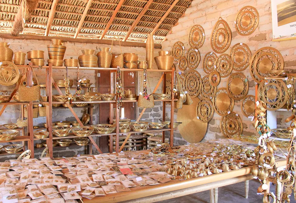
Original photograph of golden-grass handicrafts from the quilombola community of Mumbuca near Mateiros in Jalapão, Brazil
Photo: Juliana Nashimoto Neme Francisco / Wikimedia Commons · CC BY-SA 4.0 · Cropped for layout

The people and craft beyond the dunes

Mumbuca: golden grass is part of the region’s living heritage

This original June 2016 photograph documents capim-dourado craft from the quilombola community of Mumbuca near Mateiros. Woven golden grass is connected to local knowledge, identity and livelihoods; it is not simply a souvenir that appears at every roadside stop. Arrange a visit with artisans who welcome guests, ask about provenance and prices, and buy directly where possible. Do not assume the historic photograph shows the current shop or today’s production arrangements.

See where a Mumbuca visit fits in the six-day route

Travel styles

Who does it suit?

These comparative scores show who is likely to enjoy this destination most—and where expectations may need adjusting.

Repeat Brazil travellers10/10
Friends10/10
Active travellers10/10
Couples9/10
Slow travel8/10
Families with teenagers8/10
Luxury travellers7/10
Solo7/10

Brasilll

How long should you stay?

Five to six nights is the sweet spot. Four is possible on a compressed circuit, but it increases road fatigue. Six gives the landscapes enough space to feel remote instead of rushed.

Five to six nights give a first trip room for one or two main experiences a day without spending every evening exhausted on rough roads. Confirm whether the quoted tour is a loop from Palmas or involves a different end point; also ask what is included: 4x4, qualified guide, accommodation, meals, fervedouro entry fees, dune voucher and contingency if rain makes a track impassable. Smaller groups may be more comfortable on difficult tracks, but never assume a luxury-level vehicle or unlimited stops from a headline price.

For water experiences, distinguish a fervedouro from a waterfall. The spring’s upward flow creates the sensation of floating, but its fragile sandy bottom and typically small capacity demand a brief, carefully managed visit. Follow each operator’s rules on cosmetics, group size and time in the pool; do not stand on or dig into the spring outlet. Cachoeira da Velha, by contrast, is a powerful fall appreciated from authorised viewing points, not a bathing pool. Schedule a separate confirmed visit to Mumbuca to buy golden-grass craft directly from local artisans.

Found an outdated price, route or detail? Send the page URL, the information that needs changing and a supporting source if available.

Report an error →

Does this sound like your Brazil?

Use Find Your Brasil to compare this destination with the rest of the country using your own priorities.

Plan Brazil

Getting there & moving on

Use these rounded door-to-door estimates to judge the travel day. Confirm the actual service and departure time before booking.

Main planning gateway

Palmas & Taquaruçu

Typical access Flight · Road
Gateway transfer Road Transfer · ~6 h Flexible timing · Major travel day

Start by checking arrivals into Palmas & Taquaruçu, then confirm the onward transfer to this destination. Treat the road time as a planning estimate and leave some buffer for traffic, stops and local pickup arrangements.

Good onward connections

These are selected options for your next stop. Confirm operating days, connections and total travel time for your dates.