Why this place
Chapada dos Veadeiros
Chapada dos Veadeiros is a broad Cerrado destination centred on Alto Paraíso, São Jorge and the national park, with waterfalls, canyons, rock formations, long trails and cultural links to Kalunga communities.

Brazil · Nature · Ecotourism · Expedition
Cerrado plateaus, waterfalls, crystal pools, long hikes and big skies north of Brasília.
Why this place
Chapada dos Veadeiros is a broad Cerrado destination centred on Alto Paraíso, São Jorge and the national park, with waterfalls, canyons, rock formations, long trails and cultural links to Kalunga communities.
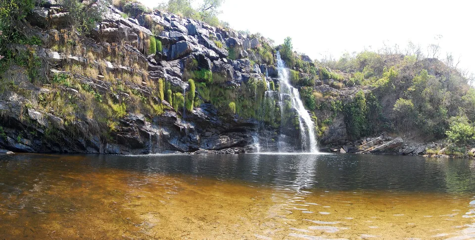
A place should not be reduced to one hero image. These views show different parts of the experience and landscape.
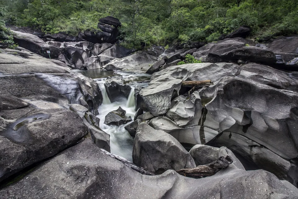
Vale da Lua is known for water-shaped rock formations in the Chapada region.
Photo: Aline Fortuna · CC BY-SA 4.0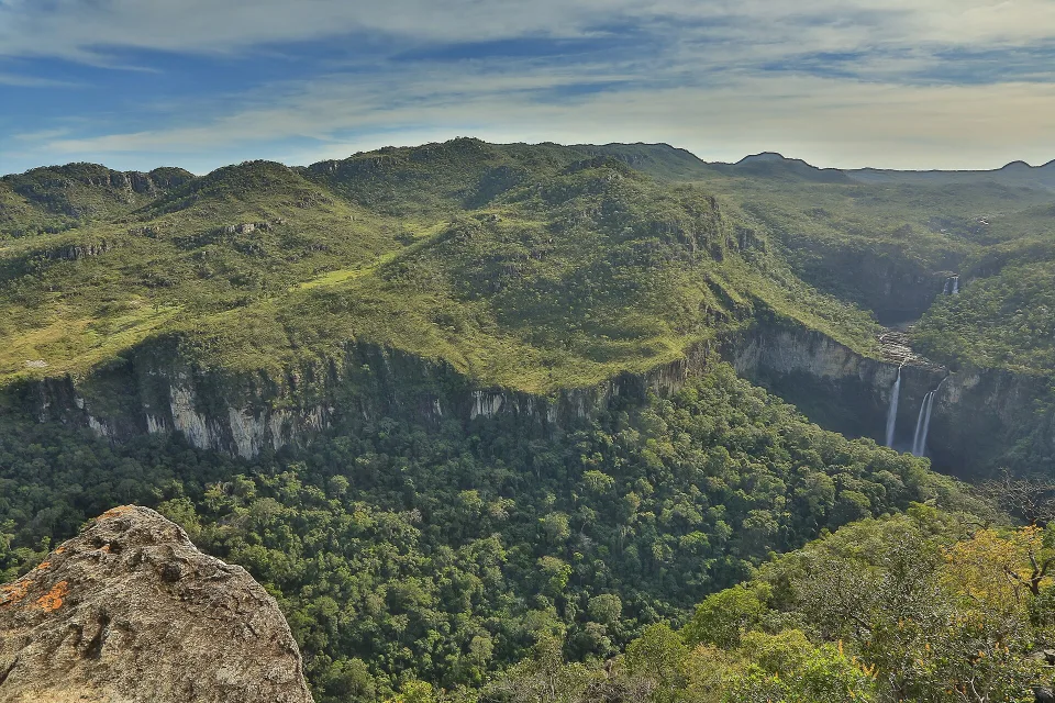
The Rio Preto falls sit within a broad plateau and hiking landscape.
Photo: Marcelo85photo · CC BY-SA 3.0The Brasilll take
Waterfalls, quartz-rich plateaus, rocky valleys, Cerrado biodiversity, Alto Paraíso, São Jorge and Kalunga territory are spread across a wide region north of Brasília. The best trips accept long drives and choose a few meaningful hikes rather than racing between famous blue-water photographs.
Open grasslands, twisted trees, rocky plateaus and seasonal water create an ecosystem very different from Brazil’s rainforest imagery. UNESCO recognises the protected Cerrado areas for exceptional biodiversity.
Rio Preto’s large falls, Vale da Lua’s sculpted rock and countless private-property waterfalls offer different effort, access and swimming conditions. One “waterfall day” does not describe the region.
The Kalunga are a major quilombola community in the region. Visits to community territory and attractions such as Santa Bárbara should be understood as visits to living communities, not simply photo access.
The same 0–10 scale is used across the catalogue, so strengths and compromises stay comparable.
These are editorial fit ratings, not visitor-review averages or safety guarantees. A high score describes a strength for a particular kind of trip. How to read these scores →
The main service town with accommodation, restaurants and road access to several attractions; easiest first base after Brasília.
Smaller, more walkable and close to the national-park entrance, particularly useful for travellers focused on park trails.
Farther north, with major waterfalls and community tourism; road time and local access arrangements deserve proper planning.
The core protected-area hiking experience with routes of different length and exposure through Cerrado and waterfall landscapes.
Visit Brasil recommends this broadly drier period for the national park. Later dry-season travel can bring heat, dust and wildfire or smoke risk, so current conditions still matter.
Attractions can be separated by long paved and unpaved roads. Group days geographically instead of returning across the region repeatedly.
National-park trails, private waterfalls and community-managed sites can have different fees, guides, reservations and limits. Verify current rules before departure.
Season matters. These monthly scores combine our current baseline for climate, access and overall travel fit.
Monthly ratings are broad planning guidance, not a weather forecast or confirmation that every activity is operating.
Arrive from Brasília, understand road distances and use a nearby shorter waterfall or viewpoint rather than a major hike.
Base in or near São Jorge and choose one of the main Rio Preto trail options matched to fitness and heat.
Use the São Jorge side for geology, shorter walking and a different type of water landscape.
Travel north only with enough time for road, local arrangements and respectful community-based access.
Choose a substantial waterfall route rather than trying to collect several widely separated icons.
Use an extra day for weather, a missed trail, a lighter nature experience or simply less driving.
Brasilll
Five to seven nights is ideal. Four can cover Alto Paraíso and São Jorge, but a week creates room for Cavalcante, varied trail intensity and road buffers without turning every day into an early departure.
Found an outdated price, route or detail? Send the page URL, the information that needs changing and a supporting source if available.
Report an error →Use Find Your Brasil to compare this destination with the rest of the country using your own priorities.
Plan Brazil
Use these rounded door-to-door estimates to judge the travel day. Confirm the actual service and departure time before booking.
Start by checking arrivals into Brasília, then confirm the onward transfer to this destination. Treat the road time as a planning estimate and leave some buffer for traffic, stops and local pickup arrangements.
These are selected options for your next stop. Confirm operating days, connections and total travel time for your dates.